Sign up for FlowVella
Sign up with FacebookAlready have an account? Sign in now
By registering you are agreeing to our
Terms of Service
Loading Flow

Downloading Image /
Downloading Image /
Downloading Image /

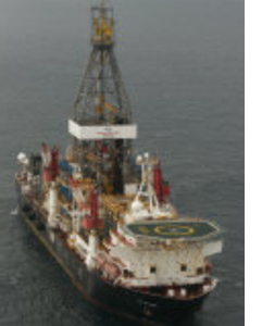
Drilling Ship- used for drilling of new oil or gas wells in deep water
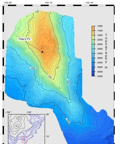
Bathymetric maps- geophysicist use these maps to understand how far they might need to travel in the ocean to find a certain volcano or area to explore
TOOLS:
Downloading Image /
Downloading Image /
Downloading Image /
Downloading Image /

FlowVella, Previously Known As Flowboard
© 2025 FlowVella
