Sign up for FlowVella
Sign up with FacebookAlready have an account? Sign in now
By registering you are agreeing to our
Terms of Service
Loading Flow

Downloading Image /
Downloading Image /
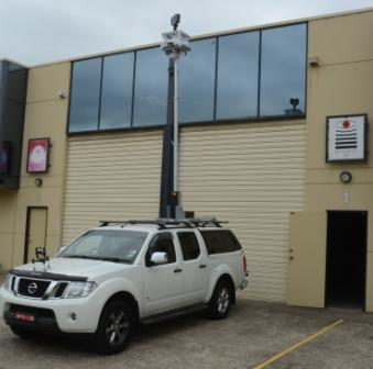
New to Wysiwyg 3D for 2014 is a newly purchased Vehicle Mounted Laser Scanning System - GPS cordinated, self levelling, height adjustable scanning platform.
Working with either of our terrestrial scanners will enable 360 degree capture whilst maintaining the hightest data quality level possible.
Processing time back in the office is greatly reduced by combining the position of the GPS and the density and detail of the terrestrial scanner with minimial impact on the environment.
More than just a "pretty point cloud", we can export the data file in a range of file formats for use by other design and construction industry professionals.
Suitable for construction, road or rail projects.
Vehicle Mounted Lidar Scanning
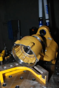
Reverse Engineering
Downloading Image /
Downloading Image /
Downloading Image /
Downloading Image /
Downloading Image /
Downloading Image /
Downloading Image /

WYSIWYG 3D Flowboard
WYSIWYG3D marketing magazine featuring company plus products & services
FlowVella, Previously Known As Flowboard
© 2024 FlowVella
