Sign up for FlowVella
Sign up with FacebookAlready have an account? Sign in now
By registering you are agreeing to our
Terms of Service
Loading Flow

Downloading Image /
Downloading Image /
Downloading Image /
Downloading Image /
Downloading Image /
Downloading Image /
Downloading Image /
Downloading Image /
Downloading Image /
Downloading Image /
Downloading Image /
Downloading Image /
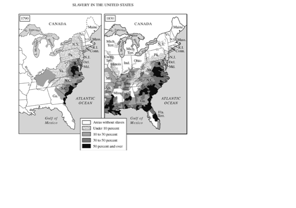
This map shows that slavery spread throughout the south and the percentage of slaves of the southern population increased greatly by 1830.
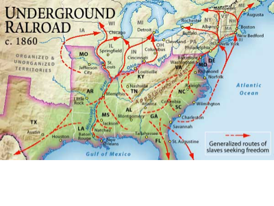
This map shows the routes that the Underground Railroad used to help slaves escape from the plantations in the south to the free North
Map 1: AP documents
Map 2: http://churchillhistory.wikispaces.com/file/view/Underground_Railroad_Map/323881468/Underground_Railroad_Map
Downloading Image /
Downloading Image /
Downloading Image /

FlowVella, Previously Known As Flowboard
© 2026 FlowVella
