Sign up for FlowVella
Sign up with FacebookAlready have an account? Sign in now
By registering you are agreeing to our
Terms of Service
Loading Flow

Downloading Image /
Downloading Image /
Downloading Image /
Downloading Image /
Downloading Image /
The Cordillera Oriental (Eastern mountain range) is the longest mountain range in the country at a length of 1,200 km. This cordillera runs from the Nudo de Almaguer to the Perija mountain range in (Northeast Colombia). When the Cordillera Oriental meets the Perija mountains it divides into two branches: The Motilones mountain range (runs north) , and the Táchira mountain range, which continues across the border between Colombia and Venezuela. The eastern mountain ranges highest peaks include: the Sierra nevada del Cocuy, at 5,330 m high. The Sumapaz moor, at 3,820 m high. The Pisba moor, at 3,800 m high.
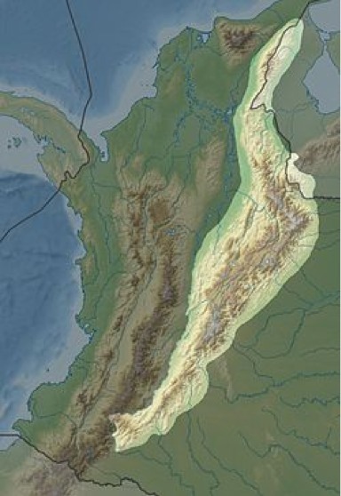
The Cordillera Oriental (Eastern mountain range)
Downloading Image /
Downloading Image /
Downloading Image /
Downloading Image /
Downloading Image /
Downloading Image /

FlowVella, Previously Known As Flowboard
© 2026 FlowVella
